4.5 KiB
4.5 KiB
| title | date | author | categries | tags | ||
|---|---|---|---|---|---|---|
| GeoTools-快速起步 | 2023-11-19 | ac |
|
|
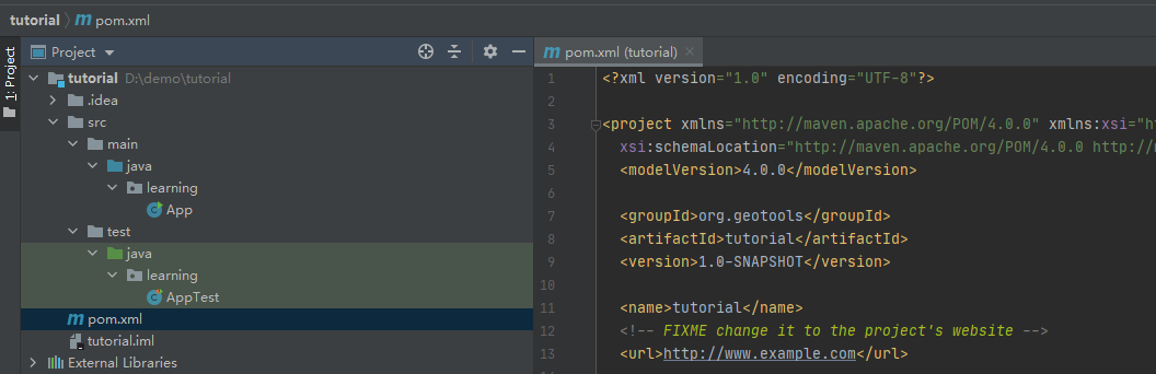
GeoTools-快速起步
1.maven构建
mvn archetype:generate -DgroupId=org.geotools -DartifactId=tutorial -Dversion=1.0-SNAPSHOT -DarchetypeGroupId=org.apache.maven.archetypes -DarchetypeArtifactId=maven-archetype-quickstart
archetype的意思就是模板原型的意思,原型是一个Maven项目模板工具包。
2. 添加依赖
<properties>
    <project.build.sourceEncoding>UTF-8</project.build.sourceEncoding>
    <maven.compiler.source>1.7</maven.compiler.source>
    <maven.compiler.target>1.7</maven.compiler.target>
    <!-- 指定geotools的版本号-->
    <geotools.version>31-SNAPSHOT</geotools.version>
    <maven.deploy.skip>true</maven.deploy.skip>
</properties>

<!-- 添加仓库地址-->
<repositories>
    <repository>
        <id>osgeo</id>
        <name>OSGeo Release Repository</name>
        <url>https://repo.osgeo.org/repository/release/</url>
        <snapshots><enabled>false</enabled></snapshots>
        <releases><enabled>true</enabled></releases>
    </repository>
    <repository>
        <id>osgeo-snapshot</id>
        <name>OSGeo Snapshot Repository</name>
        <url>https://repo.osgeo.org/repository/snapshot/</url>
        <snapshots><enabled>true</enabled></snapshots>
        <releases><enabled>false</enabled></releases>
    </repository>
</repositories>
<dependencies>
    <dependency>
        <groupId>junit</groupId>
        <artifactId>junit</artifactId>
        <version>4.13.2</version>
        <scope>test</scope>
    </dependency>
    <dependency>
        <groupId>org.geotools</groupId>
        <artifactId>gt-shapefile</artifactId>
        <version>${geotools.version}</version>
    </dependency>
    <dependency>
        <groupId>org.geotools</groupId>
        <artifactId>gt-swing</artifactId>
        <version>${geotools.version}</version>
    </dependency>
</dependencies>
3. 主程序
import java.io.File;
import java.util.logging.Logger;

import org.geotools.api.data.FileDataStore;
import org.geotools.api.data.FileDataStoreFinder;
import org.geotools.api.data.SimpleFeatureSource;
import org.geotools.map.FeatureLayer;
import org.geotools.map.Layer;
import org.geotools.map.MapContent;
import org.geotools.styling.SLD;
import org.geotools.api.style.Style;
import org.geotools.swing.JMapFrame;
import org.geotools.swing.data.JFileDataStoreChooser;

/**
 * Prompts the user for a shapefile and displays the contents on the screen in a map frame.
 *
 * <p>This is the GeoTools Quickstart application used in documentationa and tutorials. *
 */
public class Quickstart {
    /**
     * GeoTools Quickstart demo application.
     * Prompts the user for a shapefile and displays its
     * contents on the screen in a map frame
     */
    public static void main(String[] args) throws Exception {

        File file = JFileDataStoreChooser.showOpenFile("shp", null);
        if (file == null) {
            return;
        }

        FileDataStore store = FileDataStoreFinder.getDataStore(file);
        SimpleFeatureSource featureSource = store.getFeatureSource();

        // Create a map content and add our shapefile to it
        MapContent map = new MapContent();
        map.setTitle("Quickstart");

        Style style = SLD.createSimpleStyle(featureSource.getSchema());
        Layer layer = new FeatureLayer(featureSource, style);
        map.addLayer(layer);

        // Now display the map
        JMapFrame.showMap(map);
    }
}
选择一份shp文件,程序会读取该文件添加到mapContent面板中。
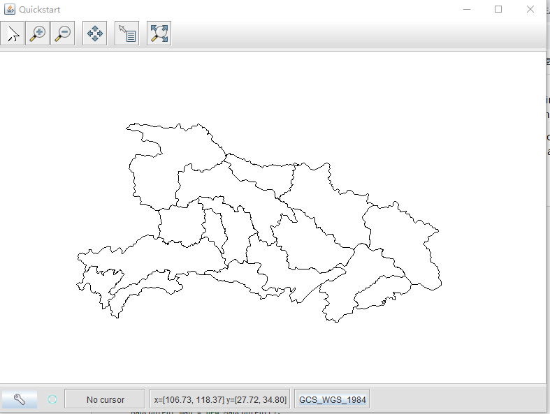
注意:shp文件没有被加载到内存中,而是每次需要时都从磁盘读取它。这种方式允许您处理大于内存的数据集。
4. advance
为了更好的交互体验,我们可以通过DataStoreFinder获取数据源时添加额外的参数,如设置缓存、创建空间索引等方法来优化。
File file = JFileDataStoreChooser.showOpenFile("shp", null);

Map<String, Object> params = new HashMap<>();
params.put("url", file.toURI().toURL());
params.put("create spatial index", true);
params.put("memory mapped buffer", true);
params.put("charset", "UTF-8");

DataStore store = DataStoreFinder.getDataStore(params);
SimpleFeatureSource featureSource = store.getFeatureSource(store.getTypeNames()[0]);